|
|
 |




|

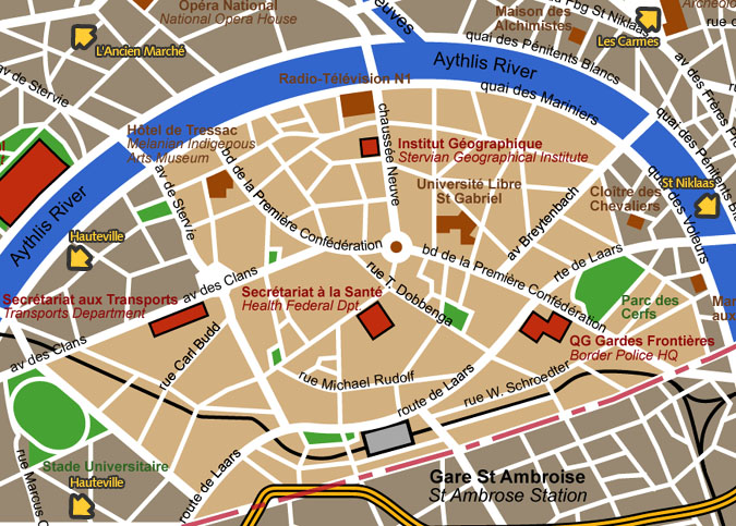
Trasaythlis district detail map Tras-Aythlis means "beyond the Aythlis"
and used to designate the southern bank of the Aythlis river, with
the exception of the western St Niklaas. A place of fields and farms,
it was the Corn Belt of yesteryear's Blakelock.
Map courtesy City of Blakelock / Stervian Geographical Institute back to the General Map of Blakelock |
|
back to the top of the page | back to splashscreen | back to general summary | contact the Stervian government |

|