|
|
 |




|

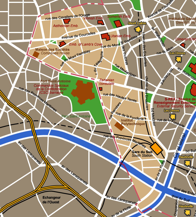
Saint Antoine district detail map St Antoine district takes its name from the
old fortress dominating it (which is itself outside the city's modern
perimeter). Together with the neighbouring Les Ormes district, it
houses many foreign embassies. The prestigious avenue de Courcelles
area has gained the nickname 'Embassy Alley'.
Map courtesy City of Blakelock / Stervian Geographical Institute back to the General Map of Blakelock |
|
back to the top of the page | back to splashscreen | back to general summary | contact the Stervian government |

|