|
|
 |




|

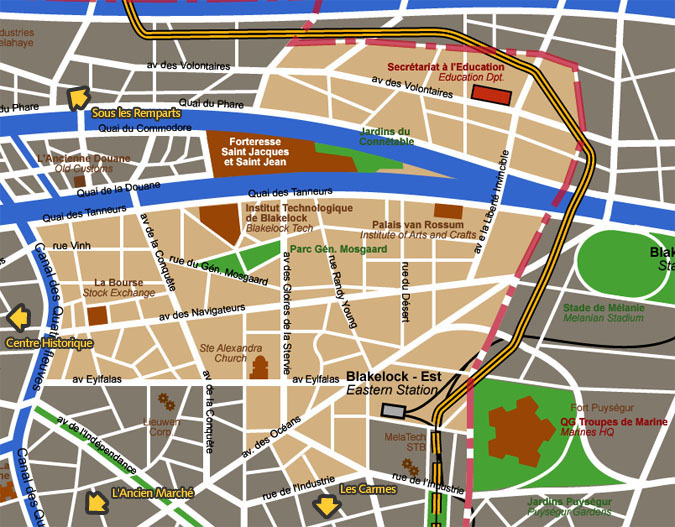
Les Marais district detail map 'Les Marais' means 'The Marshes' ; at the time
of the walled city, it was considered as its natural defense against
threats coming from east/north-east. Later, the marshes were drained
to allow construction of more habitation zones. Most of this area
(ca. 72 %) was rebuilt from scratch after the Great Fire of 128
AP which stopped only at the Four Rivers Canal on its way westward.
This explains the architectural homogeneity of the Marais District
which was designed as a whole by architect Salomon Taillefer.
Map courtesy City of Blakelock / Stervian Geographical Institute back to the General Map of Blakelock |
|
back to the top of the page | back to splashscreen | back to general summary | contact the Stervian government |

|