|
|
 |




|

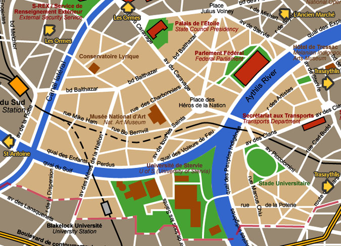
Hauteville district detail map Hauteville means "upper town". Before
the growth of Blakelock finally encircled it, Hauteville was a green
district, with many country mansions.
Map courtesy City of Blakelock / Stervian Geographical Institute back to the General Map of Blakelock |
|
back to the top of the page | back to splashscreen | back to general summary | contact the Stervian government |

|