|
|
 |




|

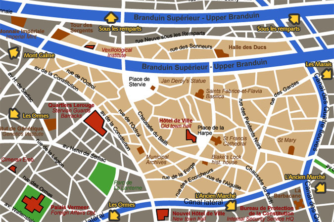
Centre historique (Historical District) detail map This area was the early town of Blake's Lock
(or Blaeklaar in Stervian). District limits follow the ancient ramparts
line (they were demolished between 220 and 245 AP) north and west
; the southern limit follows the Canal Latéral ; the eastern
limit follows the Canal des Quatre Fleuves (Four Rivers Canal).
Map courtesy City of Blakelock / Stervian Geographical Institute back to the General Map of Blakelock |
|
back to the top of the page | back to splashscreen | back to general summary | contact the Stervian government |

|